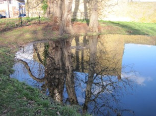
Carshalton Springs and Watercourses, February 2014 - John Phillips
After a period of unusually heavy rainfall in February 2014, Carshalton’s Springs and Watercourses came to the fore, reminding us of what were once always-present natural features of the area.
John Phillips wrote at the time: "Carshalton was a village of springs and watercourses. The ’al’ bit of its name is derived from spring or well. The springs and water courses – which now flow only after an exceptionally wet winter – used to flow all the time.
The current flow is the highest I have ever seen although I have only been interested in the water courses since the late 1980s.
|
The last really big flow was in 2000-1 following a very wet autumn. There was then somewhat under a metric ton of water per second flowing over the gauging weir in The Grove just downstream of Carshalton Ponds. A few days ago the measuring part of the weir was full and water was flowing over the surrounding brickwork. I have not seen this before. The highest recorded level at the weir was on 20 July 2007 but this was caused by a massive thunderstorm not ground water. The river level at the weir may be found on the Government’s Flood information service page HERE."
Many of these features became visible once more six years later, in February 2020. Key to Carshalton Water Courses map
Present water courses light blue. Underground culverts dark blue. |
- The Carshalton House Lake now in the grounds of St Philomena’s School. This is fed from the spring head at the southeast end of the lake. The lake has been altered several times. It was given its present form in the mid-18th century
- The Water Tower. Built about 1718 as part of the gardens of Carshalton House. It contained a cold bath, water driven pump and orangery. Find out more about the Water Tower HERE
- Margaret’s Pool. Originally the Water House Pond through which West Street Passed in a ford. It was cleaned and improved by John Ruskin in the 1870s. The dedication stone and some of the ornamental stone remains. The pool was renamed in honour of Ruskin’s mother
- Wandle Lodge Pond in the garden of a former house called Wandle Lodge
- Honeywood Museum with Victorian and Edwardian water features in the garden
- Channel in the grounds of the Lodge
- Upper Pond probably created for the Earl of Arundel in the 1630s. The road causeways date from the 1820s
- Lower Pond probably created for John Cator, owner of Stone Court in what is now The Grove Park, about 1690-1700
- The cascade in The Grove Park – an old weir rebuilt in the 1960s
- The Environment Agency’s flow gauging weir
- Upper Mill. An ancient mill rebuilt in the 1880s as an electricity generating plant
- Spill way at the end of the Westcroft Canal. The canal once extended further north to a snuff mill on the site of the present paper mill close
- The Grotto Canal. The straight southern end was created in the early 18th century as a water feature in the grounds of a large house which was never completed. The northern section, between Ruskin Road and the High Street, appears to be an alteration of later 18th century date
- The Hog Pit probably originated as a chalk pit. It existed in the late Middle Ages. It was reshaped as a garden feature in the eighteenth century and supplied water to a mill by Lower Pond
- The grotto. Built about 1724 as a garden ornament it was once decorated with sparkling slag and glass waste, seashells and red ‘coral’ made of lead. Some of the decoration can be seen in the Water Room in Honeywood Museum
Text and images Copyright © John Phillips 2014


